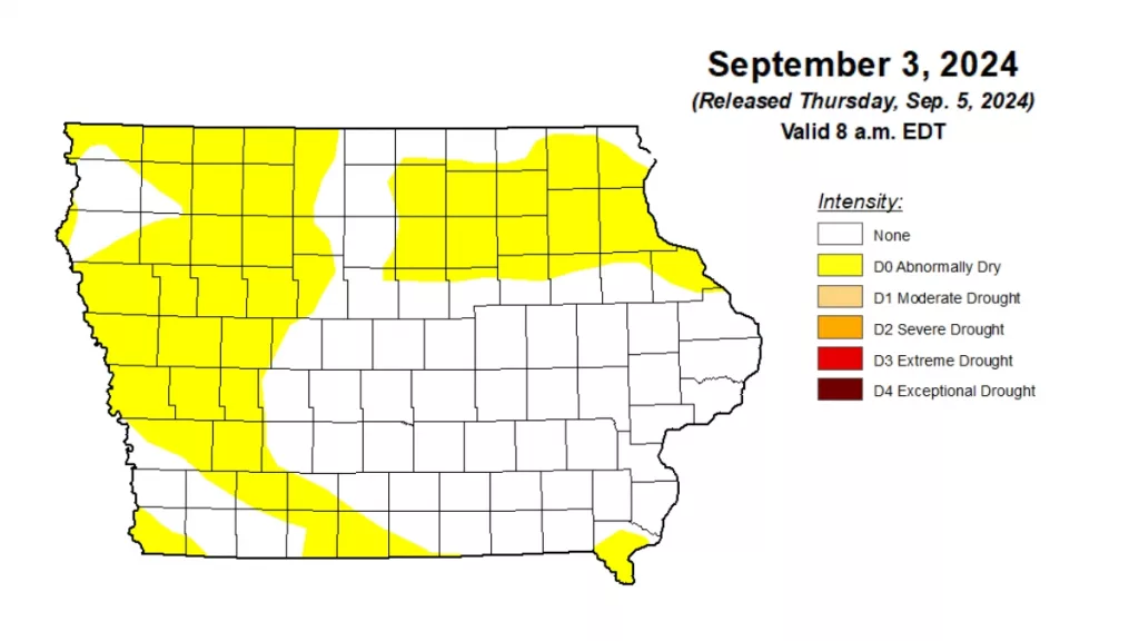
Above-normal rainfall in early summer slowed significantly in August, leading to a return of dry conditions, according to the latest Water Summary Update from the Iowa Department of Natural Resources (DNR). Preliminary statewide precipitation for August measured 3.20 inches, nearly an inch below normal. The most recent U.S. Drought Monitor map shows almost 40 percent of Iowa is now designated as abnormally dry, with western and northeastern areas seeing the most significant changes. While August saw below-average rainfall, the summer months of June, July, and August had near-normal temperatures and slightly above-normal precipitation. The state has received more than 38 inches of rain over the past 12 months, over twelve inches more than the prior 12 months. DNR Hydrology Resources Coordinator Tim Hall says, “We are to the point now where rainfall will begin to build up next year’s soil moisture and groundwater, so a wetter than normal fall would be great to see. If conditions remain dry, we could have issues going into 2025.” The Water Summary Update is prepared monthly by staff from the DNR, Iowa Department of Agriculture and Land Stewardship (IDALS), IIHR—Hydroscience and Engineering, the U.S. Geological Survey, and the Iowa Department of Homeland Security and Emergency Management. A link to the complete August 2024 report is included with this story on our website.
______

