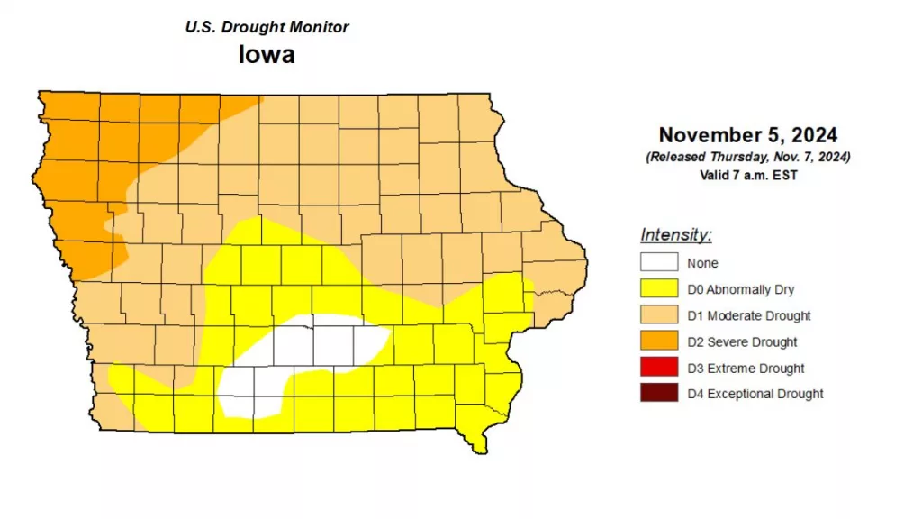
Iowa’s driest September in 152 years continued into nearly all of October, according to the latest Water Summary Update. Preliminary data showed October precipitation statewide averaged 1.90 inches, 0.79 inches below normal, with combined rainfall for September and October nearly 3.5 inches under typical levels. Fortunately, late October rains provided some relief, slowing the worsening drought conditions. The latest U.S. Drought Monitor map indicates nearly all of Iowa remains in drought, with northwest areas experiencing D2, or severe drought. Five of the seven counties in the listening area fell into the D1, or moderate, drought category, with the exception of Greene and Guthrie counties, which are classified as D0, or abnormally dry. Iowa Department of Natural Resources (DNR) Hydrology Resources Coordinator Tim Hall says, “The rains that came during the last week of October, and rains that have continued into early November have really helped improve conditions. The state remains short of rainfall for the fall months, but National Weather Service outlooks are favorable. Continued normal or above normal rain in November and December is critical as we head into the winter months.” The Iowa Water Summary Update is prepared monthly by technical staff from Iowa DNR, the Iowa Department of Agriculture and Land Stewardship, IIHR—Hydroscience and Engineering, and the U.S. Geological Survey, in collaboration with Iowa Homeland Security and Emergency Management Department. A link to the complete October report is included below.
______


