


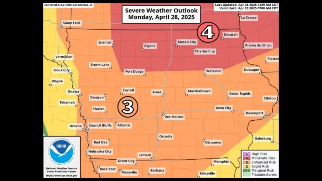
Severe weather is predicted across Iowa tonight (Monday), according to the latest weather briefings from the National Weather Service (NWS) in Des Moines. Forecasters have placed parts of northern Iowa under a Level 4 risk for severe weather, with the remainder of the state, including the immediate listening area, falling under a Level 3 risk. Damaging winds, very large hail, and tornadoes — some strong — are all possible with tonight’s storms. Current forecasts show the most significant threat will occur between 4 p.m. and midnight, with storms likely to develop quickly. Tornado chances are estimated between 10 to 15 percent for all but the southernmost tier of counties, and wind gusts of 60 to 70 mph are possible for nearly all of Iowa. The whole state has a more than 30 percent chance of hail larger than one inch. Officials are urging Iowans with outdoor plans to stay weather aware and emphasizing the importance of having multiple ways to receive warnings. According to NWS staff, most of the state will not see storms today; however, they have the potential to be extremely strong and dangerous where they do appear. In the event of local severe weather, your Carroll Broadcasting stations, KCIM, KIKD, and KKRL, will provide coverage. Information from the National Weather Service is also available online at www.weather.gov/dmx.